Dec. 1 Placido Bayou
Placido Bayou is an urban paddle that lies extremely close to my home and was an opportunity to explore a new launch site and get more experience using my GPS. Why would I need a GPS so close to home in an urban setting you ask? This trail is a mangrove maze and in the past, I have had some trouble finding the entrance to Placido Bayou, which is very subtle from the flats. The new launch is at Puryear Park, home to youth soccer. The launch sits unnoticed on the Westernmost fringe of the park. It sits off a pine needled jogging trail which circles the soccer fields. There is a space for a couple of vehicles to park and I'm betting this launch is seldom used. To kayak this trail, you MUST do it at high tide or you will be stuck dragging your paddlecraft through soft mud. When I checked the tides for today, conditions were favorable, so off I went.


When I was a kid, I took a few hikes through the mangroves near the trail. Be warned, however, that on this trip, I ran across a homeless guy in the woods while exploring a foot trail I had ventured on before; people are the most unpredictable and dangerous creatures in the wild, so I gave him a wide berth and retreated seemingly unnoticed.
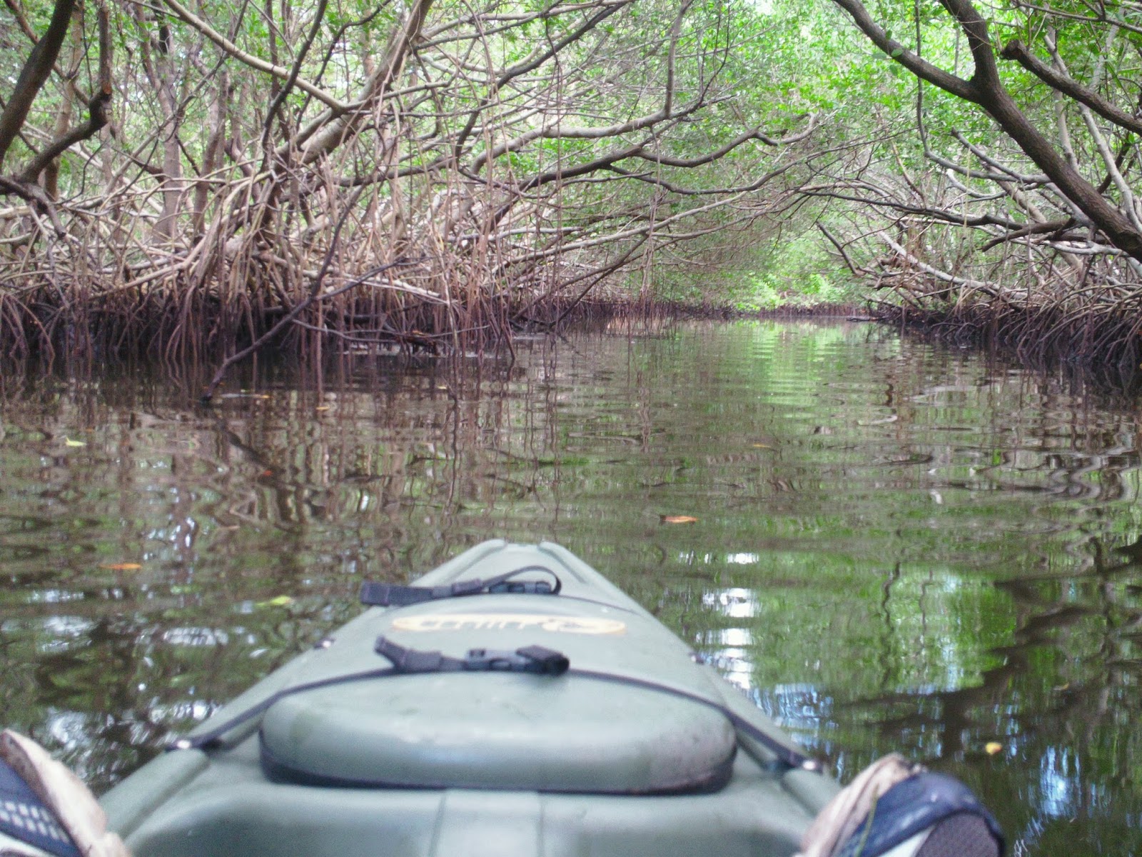
Getting back to kayaking, the trail starts off as a long mangrove tunnel that has several different offshoots, most of which will leave you in very skinny water. I took one channel that led to a small pond filled with mullet.As far as wildlife goes, I have seen snook, snapper, redfish, and tons of mullet and stingrays in these waters. After exiting Placido Bayou, I marked my position via GPS, as it is virtually unnoticeable. It empties into a marsh like mangrove filled area. I explored this section heading towards what I thought was open water, but I traversed more mangrove tunnels, one of which led to a dead end in someone's backyard.


 |
Lost? In mangrove country
|
I backtracked and glided through these very shallow,clear waters watching schools of fish flee my presence. I noticed quite a few sting rays darting off across the flats as well. Soon, I found open water that leads towards Smacks Bayou and the Snell Isle/Shore acres area of St. Petersburg . There were many large white pelicans hunting for baitfish and the schools of fish were very thick, revealing tailing redfish and enormous schools of mullet. I continued on towards the Western side of the bayou along the mangroves. I stopped for a few minutes to explore a small island that had been used for camping and drinking parties, judging by the amount of beer cans on the island. I continued on to the 40th Ave bridge and turned around.
 |
| campground in suburbia |
 |
| "Under the bridge that time........" |
 |
| The placid bay |
 |
Holly?
|
As I headed back into mangrove country, I turned on my GPS and it led me towards the area where the little creek had entered the maze. I knew generally where I was at, but the precise spot is a little tricky. I passed by it once at 25 feet or so from the spot, which was the accuracy decreed by the satellites I had commisioned. I did a full circle and then realized I had to trust the GPS fully and found that the entrance, indeed, did not look like the entrance. Soon, after gliding through this remote looking labrynth, I was back at the launch.
No comments:
Post a Comment