Aug.17 Rainbow River
Dunnellon
 |
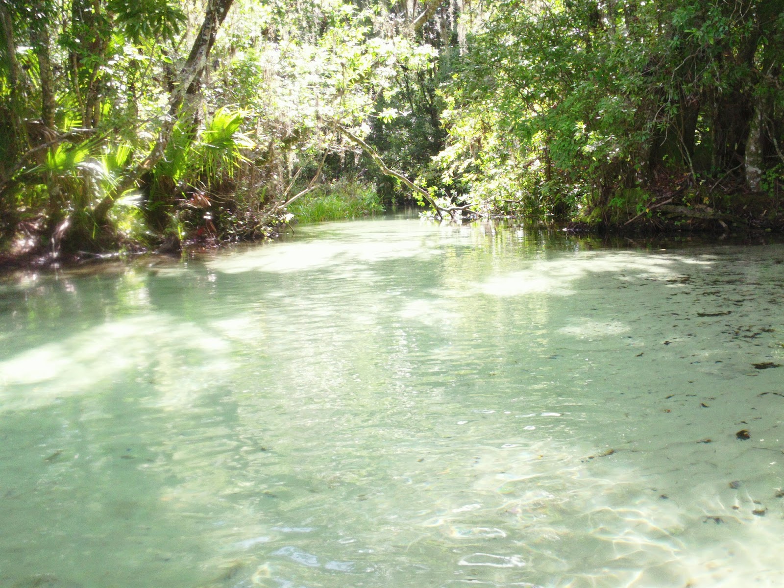
| Rainbow River vista |
I have been visiting Rainbow River since 1983, when I went tubing as a teenager for the first time and was hooked for life. This river is perhaps the most beautiful river in all of Florida. If you took a poll asking Floridians which river was the most beautiful, Rainbow River would be at the top or near the top. This nearly 6 mile long spring fed river is a tributary of the much longer tannin stained Withlacoochee River. It discharges about 400-600 million gallons of water a day from its many springs located on the river.It is very popular with tubers,which attracts thousands of visitors each year to its crystal clear,blue green colored waters. My goal for today was to paddle from the 484 bridge, a popular put in/take out called Blue Run to the headsprings and back. I have only paddled this river one other time on a stand up paddleboard, but didn't make it all the way to the headsprings.This would be my first time exploring the river from KP Hole(a popular county park that rents tubes and paddlecraft) upriver to the headsprings. This would also be my second tributary paddled of the Withlacoochee, Gum Slough being the first earlier this year. This river is about 100 miles North of Tampa Bay and is among my Nature Coast destinations.
I recently acquired a GPS device, so I plotted my route up and down, to get familiar with it. Upon arriving at the launch, I fired it up and it read that I was 19.2 miles away from the headsprings .Apparently the coordinates I entered the day before were wrong! No matter, I would definitely know exactly how many miles I paddled as well as the correct coordinates. I want to familiarize myself with this, as I am planning on paddling some navigationally tough trips down the road. I had a pleasant drive up and at the launch, I chatted with a very lonely older guy who lamented that he has had a hard time meeting women who want to kayak with him. Then he mentioned he had been married five times. Yikes! Nice guy though. He had just finished cycling a trail by the launch. Lots of outdoor activities in Florida. I shoved off at a hair before 8:30 and started upstream.
 |
| at the launch |
For a weekday, the river seemed popular as the parking lot was 3/4th full, but for the most part I had the river to myself. One thing that absolutely amazes me about this river is that even with the population of homes on it, boaters, tubers and paddlers, the water and scenery still remains pristine. There was an abundance of winged wildlife on this trip: cormorants, anhingas, moorhens, and a few raptors or hawks. The cormorants were fun to watch as they darted beneath my kayak in the clear waters searching for food. they are quite the fishermen, as are the anhingas who pose on logs with their wings spread out, drying them off. It is easy to confuse anhingas with cormorants, and from my observations, the easiest way to tell them apart is that the cormorants will let you almost touch them before they fly off, if they do at all. Cormorants are funny to watch, as I pass five of them sitting on logs with their throats vibrating. The more I explore these rivers, the deeper my appreciation is for the winged wildlife.
I arrive at KP Hole at around 9:30, and my GPS states that I have paddled 2.8 miles. Just beyond the park, I enter a small creek known as Gissy Spring Run. I paddle up a very beautiful and secluded creek that ends with a gate across it. This blocks visitors from entering Gissy Springs. It is reminiscent of Juniper Creek, which I will visit later this year. I continue upriver, which puts me in new territory- I have never explored this section before. There is a long stretch of marsh grass and a narrow alley between it and the wooded bank on the East side of the river. The water is very deep here, maybe close to 20-30 feet deep. I pass a few boaters who have stopped at a large tree hanging over the river, looking to rope swing over and into the river. It is getting very warm out and I desire to do the same.
 |
 |
Gissy Spring run
  |
Recently,around this section of the river, two younger kids were stalked and pursued by a very aggressive, large alligator. KP Hole closed its operations for nearly two weeks until three alligators were captured and removed from the river. I have mixed emotions about this as I feel sad that these gators were taken from their habitat and likely euthanized. Alligators are a big reason why I love to kayak Florida freshwater.Incidents such as the one described above as well as much more unfortunate ones that have resulted in death or dismemberment are on the increase as more people than ever before visit or live in our state and discover watersports. Alligator populations have also increased due to conservation efforts that have successfully transformed the species from endangered to thriving. These two factors are creating potentially dangerous situations as many people harrass or feed these alligators which in turn lose their natural fear of man. Bottom line is that these alligators had to be taken before a death occured.
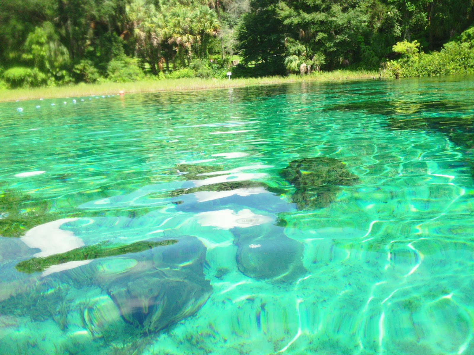
I reached the state park at the headsprings at around 10 am or so and took a break. I had paddled 3.75 miles upriver. The current is about .5-1 mph and I am averaging 4 mph downriver and 3mph up. I float outside the roped off swimming area and sit sideways on my yak to take a break. I feast on chocolate covered cherries and almonds.I am also out of Gatorade. On the Rainbow River you can only take non disposable items- no plastic bottles or bags, so I exhausted my supply of Gatorade on the way up. What to drink? Ah, have no fear-I brought my Lifestraw, my water filter. I simply scooped some fresh,72 degree river water up and sipped it up with my straw. The water was cool, but not too tasty. I paddled a little ways downriver and stopped in a very nice scenic part of the river with no development. I looked at a limestone rock formation on the bottom, about 15 feet deep and watched a school of bright metallic blue colored Buffalo shad swim around. I dipped my camera in the water to film them and soon I had about 20 small bluegill surrounding my camera, which made for some colorful footage.
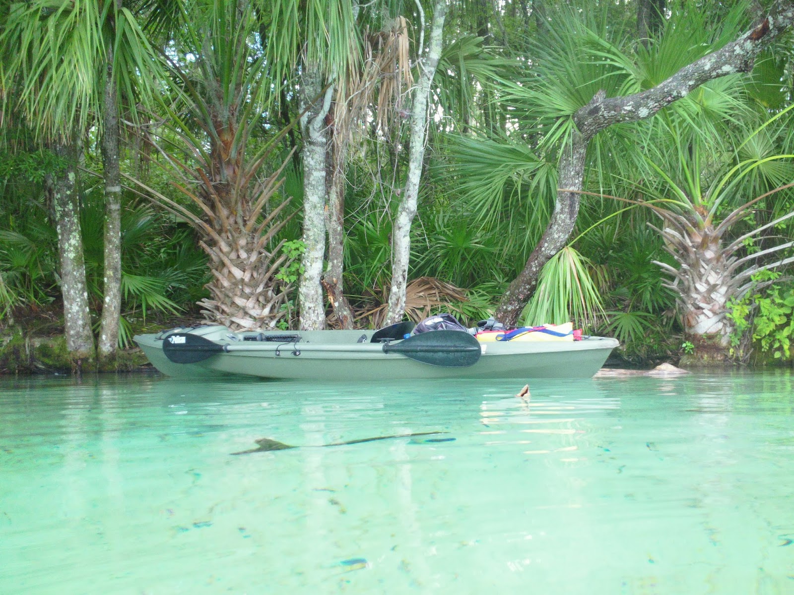
 |
the natives
 |
I took my time downriver and stopped for a swim and snorkel. I talked with an older gentleman and his son or grandson. The cool water felt like heaven. Instantly refreshing. It kept me refreshed for almost my entire trip down, as well as my wet canvas hat I would dip into the river and throw over my head. I spied more cormorants fishing, and a large softshell turtle moving through the eelgrass, which is very plentiful here-a good sign. I stopped about a mile upriver from the launch and swam with a big old black lab named Anna, who was swimming alongside her owner's kayak. I passed the launch and ventured 0.6 miles down to Blue Cove, a cloudy blue green colored spring about a mile or so frrom the confluence of the Withlacoochee River. I paddled back upriver again and stopped just outside the launch and dove off of a large cypress tree a couple of times to cool off. All told, I had paddled over 9 miles in the August heat which felt glorious with the cool clear waters surrounding me. I had been to Rainbow River once more and countless trips before. Each time afterwards, as well as today, I vowed to be back sooner.

 |
Dream house
|
NOTES: The Rainbow River was once called Wekiva River as well as Blue run, one of the many called as such in the state. This was always a popular destination and artifacts found here date back 10,000 years. Rainbow Springs state park costs 2 bones to enter and has an artificial waterfall. You can paddle up here and pay if you want to stop which is much better than trying to find a parking spot. Dunnellon's Blue Run is a free launch! Get there early, as it is very popular. Bring your bike as well if you're feeling vigorous. No disposables are allowed on the river, which may explain the pristine condition of the river as it coexists with a very populated area.
COORDINATES: Elev 131 ft. N29 deg.02.957' W082deg26.841' Blue Run Launch
KP Hole: N 29 deg 05.221' W082deg 25.696' 130 feet elev
Rainbow Springs: N29 deg 06.132' W082 deg 26.244' 119 ft.elev


